
The Perfect Keweenaw Waterfall Tour Guide
If you are headed to Michigan’s Keweenaw peninsula, you have to add waterfall hunting to your itinerary. There is no better place to stop and see the falls than the copper country because most of them are easily accessible, with a handful being right of M-26 or other roads. Whether they are on the way to the final destination, or on the way home, there’s no excuse to not stop and see these wonders.
*note, I did not put this in any particular order. But if you click on the map below, I have made a directions guide that will take you to each of the falls*
Jacob’s Falls

Along M-26, you can find Jacob’s Falls near the famous The Jampot monks store. Jacob’s Falls is a tall 20 foot slide, but you can also find a 2.6 mile loop that follows the river. It is a moderately challenging trail that takes an average of 1 hour and 16 minutes to complete, but it is a stunning trail with handcrafted benches. If you choose to spend time on the trails, I recommend beginning at the Monk Trails trailhead.
Eagle River Falls

The Eagle River Falls is a stunning 40 feet drop, deep river gorge that you can view from a historic Lake Shore Drive Bridge. The pedestrian bridge is actually the former high way bridge that was constructed in 1915 and made of steel. The bridge is 136 foot long and 17 foot wide Warren deck truss bridge and was converted to a pedestrian bridge in 1990. The timber bride (M-26) was completed in 1990, allowing the former bridge to be conserved for history.
Related: 5 Must-do Kid-Friendly Hikes in the Keweenaw
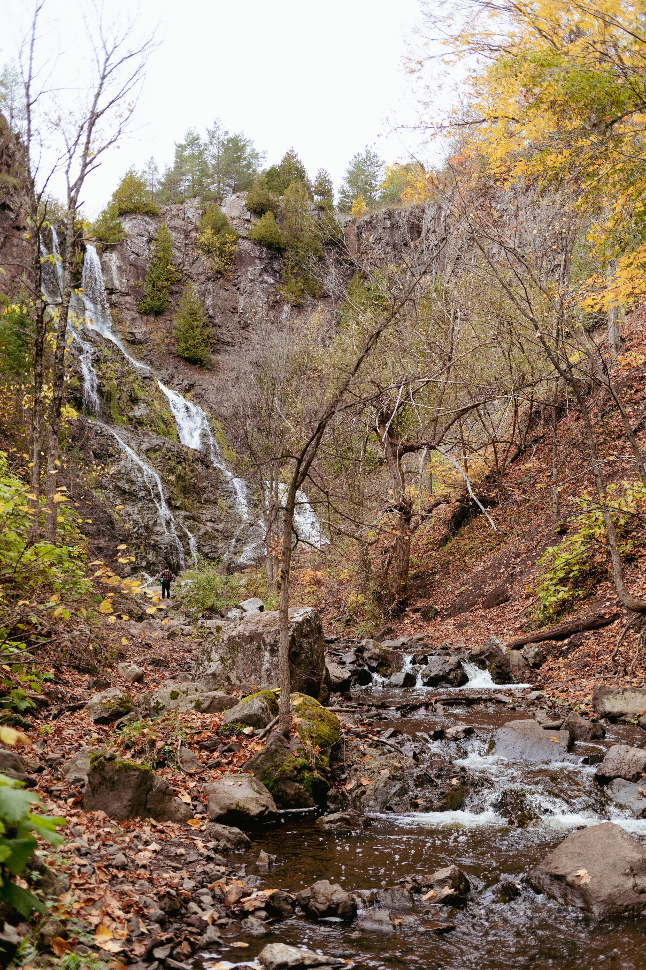
The Hungarian Falls

The Hungarian falls makes for a beautiful hike with 3 stunning waterfalls along the trail. With a 2.7 km loop, this moderately challenging trail will take you through beautiful woods and along the river. You are permitted to enter the water and climb the cliffs at your own risk.
Douglass Houghton Falls
I’ve been told the Keweenaw is working to make a proper pull off and viewing spot for these falls. Douglas Houghton Falls is Michigan’s tallest waterfall at 110 feet and makes for a stunning view! The hike is short and easy at 0.5 miles. I highly recommend viewing from the top of the trail unless you are an experienced climber. The best view from above is to take a left just before the falls. There is currently a marker with a pink ribbon to indicate where to cross. Once you cross the creek, follow the path until it comes to a clearing. The falls will be to your right. This once popular destination has now experienced the crumbling cliff wall where the trail is completely washed away. Although we, and others that day, climbed to the bottom, I would not do that again until our children were much older and better at climbing by themselves. Update May 2023: A rope has been provided to assist climbing up and down. Update August 2023: Markers have been put in place along the trail to indicate where future trail work will be, overlook safeties, and stairs. The area has recently been purchased by the state.
Related: Rustic Camping in the Ottawa National Forest
Gardener’s Falls

Across from the Calumet Township Park (also known as Calumet Waterworks), you can find a 1-mile path leading through the forest. Along the trail, you can find a tiny cascade falling over mossy rocks and logs. This is the Gardener’s Falls. Afterwards, you can head to the Calumet Waterworks park for more stunning views, exploration, rock hounding, and a playground. There are handicap accessible benches, picnic tables, and a ramp down to the beach at the park.
Queen Anne’s Falls
Tucked away from the main attractions, Queen Anne’s Falls is a local secret where the falls crash over blocky chunks of volcanic rock. Being a less traversed trail, it can be difficult to find. Head to the Drift-Inn Bar in Copper City, MI. There, you can find a small utility pull-off just west of the parking lot. From there, you will follow an ATV trail where you will take the first fork to the left. After you pass a lake, take the trail left again and follow the main trail until you reach the waterfall.
Conglomerate Falls Natural Area
The Conglomerate Falls here are more like mill-race rapids. The natural area that surrounds a historic cabin recently expanded from the original 40 acres to 275 acres with 1.3 miles of the Gratiot River. This is a well known fishing spot and great for birding. You can find it from Five Mile Point Road to South Farmer’s Block Road and Conglomerate Falls Lane (east side) or Gratiot River Shortcut Road (west side).
Related: The Complete Houghton, Michigan Travel Guide
Tobacco River Falls

Less than a mile north of Gay, Michigan, the Tobacco falls consists of a small series of stepping drops before pouring into Lake Superior. This park is right along the road near the river’s bridge. There are paths leading from the road down to the falls, so you can go over the road or under the bridge.
Eister Falls
The trail to Eister Falls is a one mile trail loop with a bluff lookout from the top. At the lookout, you look down on the waterfalls that cut deep in a conglomerate gorge. It is a steep, uphill climb if you follow the trail. Should you choose to cut off the trail and follow the creek, climb one at a time and be careful. But there, you will have a more direct view of the falls.
Silver River Falls
The Silver River Falls is an iconic waterfall in the Keweenaw. They are composed of two sets of drops below a historic sandstone bridge. Right before the Brockway Mountain Drive’s west entrance, you can find a bridge marked with ‘Silver River’. Park off the shoulder and head down the north side of the bridge, down the sandstone stairs, and you can find the Upper Falls. From here, you can follow the river down stream to see the lower falls. The falls are a wide drop over conglomerate rock.
Related: The Complete Travel Guide: Copper Harbor
Haven Falls

Haven Falls can be found in a small roadside park in the town of Lac la Belle. You can find a pavilion with restrooms and picnic benches. Depending on the season, the waterfalls may be a foaming curtain or just a trickle of water down the conglomerate rock.
Montreal Falls

The trailhead for Montreal Falls is found on a private road, but they allow for hikers to come and park. So if you decide to visit this trail, be sure to be mindful of the roadway. There are two gate areas, if the first gate is closed, you will have to walk the road for a half mile before reaching the trailhead. Once you reach the trailhead, you can find a fairly easy trail that follows the shoreline until you reach the falls. The falls cascades over black volcanic rock into the lake. If you want to keep hiking, you can follow the trail to the Upper Montreal Falls, which is far less traveled.
Manganese Falls

You can find this one just outside Copper Harbor and it is one of the last waterfalls on the tip of the Keweenaw Peninsula. This waterfall drains into Lake Fanny Hooe at a quick 100 foot drop. You can find a small viewing platform on a trail right from the road. If you want to get a closer view, follow the trails downstream and slowly climb down the gorge to a wooden bridge that leads over the creek. From there, you can follow the creek and gorge back upstream to the falls (this is the route we always take).
Related: Spending Fall in Copper Harbor
Redridge Falls


The historic steel Redridge Dam, that no longer holds back water, actually makes for an excellent waterfall spot. You can park along the edge of the road, then look for the large rocks blocking off entry way to a trail. This will be an easy route to the back of the dam where you will find the original timber crib on the Salmon Trout River. The crib is a collection of logs and earth that still hold back a large reservoir, yet water pours over and through the wood to form a beautiful, wide set of cascades.
Wyandotte Falls
The Wyandotte Falls trailhead can be found just south of Twin Lakes South Park, toward the Wyandotte Hills Golf Course. From there, you follow the trail south to Misery River. The waterfalls can be found just past a set of ponds next to a small set of cabins. Surrounding the falls are huge cedar trees and moss-covered rocks. It’s a quick, quarter mile, walk to the falls.
A Few Falls Outside the Keweenaw Peninsula That Are Worth Stopping For
Canyon Falls
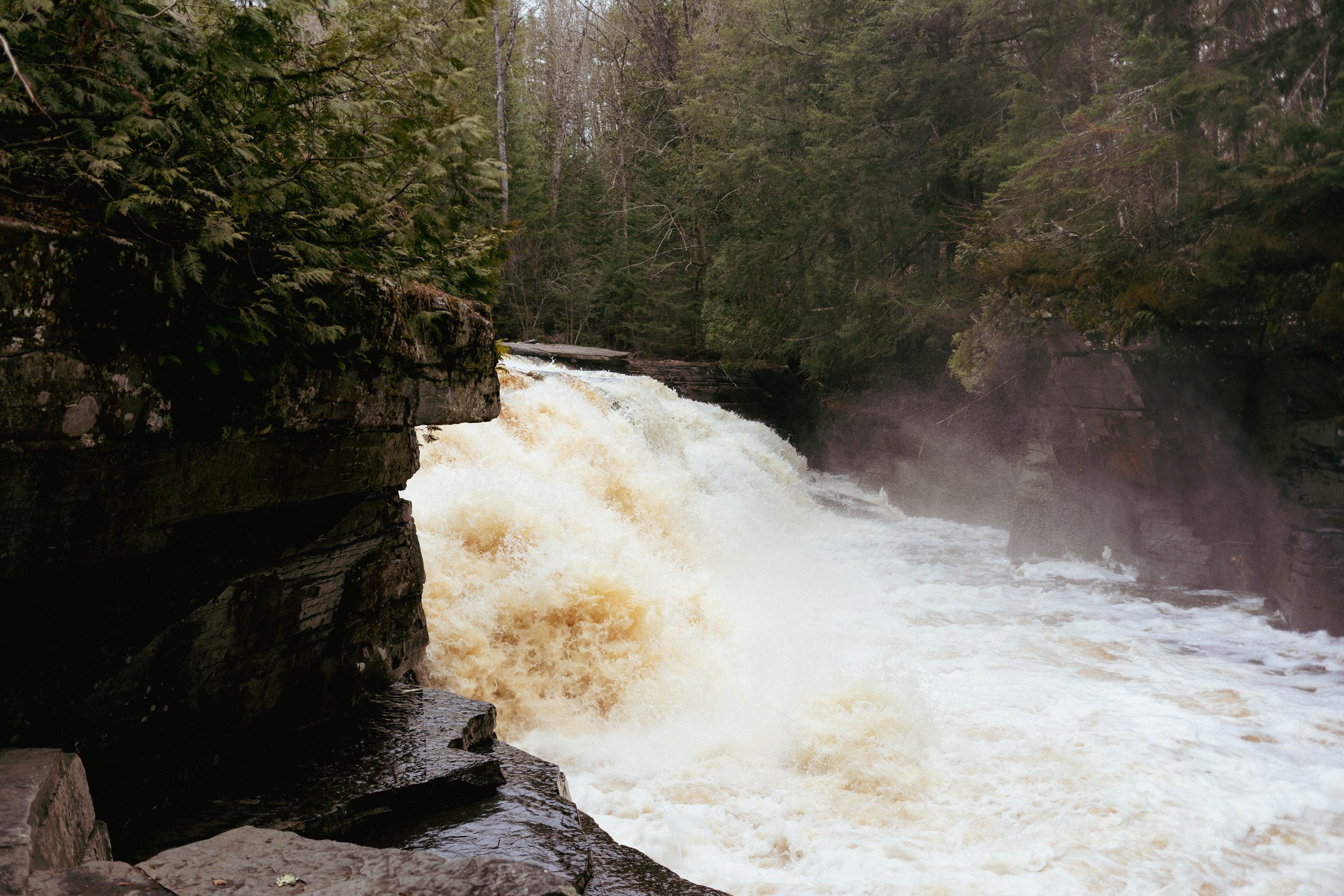
You can find a very well-kept pull off site for the Canyon Falls with picnic tables, clean bathrooms, and a map. From there, you can follow the very easy trail down to the Canyon Falls on the Sturgeon River. These falls have been carving at the surrounding slate for thousands of years and have become known as Michigan’s Grand Canyon. Its about a 2-mile round trip hike to the falls and back, however you can continue to follow the trail to the gorge, which is about 4 miles round trip, where you can also meet the North Country Trail.
Bond Falls

The Bond Falls has a 50 foot drop, surrounded by beautiful boardwalk with 6 viewing locations. There is a well paved pull off with restroom, trash cans, and you can find picnic tables near the top of the falls. If you are able, I highly suggest taking the stairs up and continuing the follow the trail up the Ontonagon River for more beautiful falls and dense forest views.
O Kun De Kun Falls

The trail to O Kun De Kun Falls is an easy hike through the beautiful forest. There is a small pull off to park, with ample trail signs, and a well traversed trail. From there, the hike is a little over a mile to the falls, where water curtains over sandstone. You can walk out on top of the falls for a view facing the bridge, climb down just before the bridge, walk onto the bridge, or go past the bridge for a closer view, so many options! It is a plunge falls, so if you are careful you can go behind the falls. When we went, the water was absolutely filthy so use your best judgement.
Agate Falls

This wonderful waterfall is actually a Michigan State Scenic Site just 6.5 miles east of Bruce Crossing on MI-28. You can find a roadside park, then follow the paved trail under the bridge to the overlook. The overlook is limited in views, so if you are more adventurous, you can find a trail around the fence down to the water for a view from the bottom. Or, you can climb up to the old railroad bridge that is now an atv/snowmobile trail.
Black River Area

This 2.5 mile out-and-back trail near Ironwood is a generally easy route. The trails are well marked, but be mindful on the stairs. Some of the steps are rotting and are lose. You can find wonderful boardwalks and well-placed viewing platforms. If you do the whole trail, you can see Rainbow, Potawatomi, Gorge and Conglomerate Falls!